Product
Frame
Mode
Timeline
— click to jump to a year · drag the end dots to limit the span
—
DETAIL — zoomed to the change hotspot
NASA-CCM PARTNERSHIP
GROWING-SEASON RECORD
Live analysis apps Google Earth Engine · project nasa‑ccm
Change maps RAP cover 1986–2025
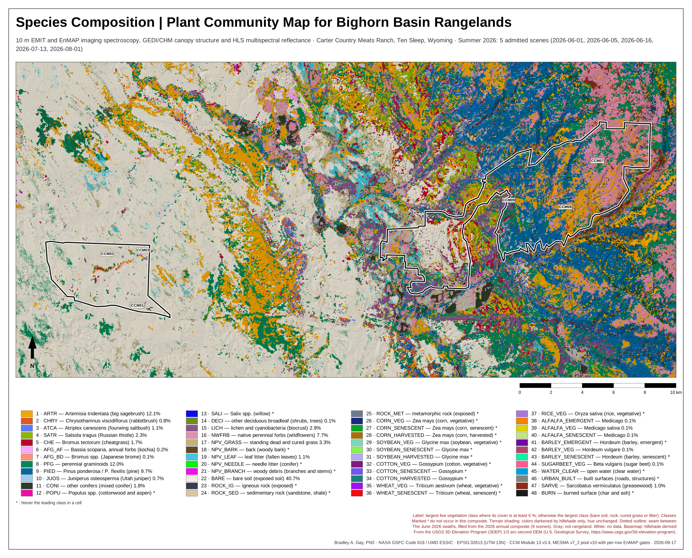
Species composition CCM Module 13 v3.4 · EMIT + EnMAP imaging spectroscopy, 10 m · summer 2026 · delivered 2 October 2026
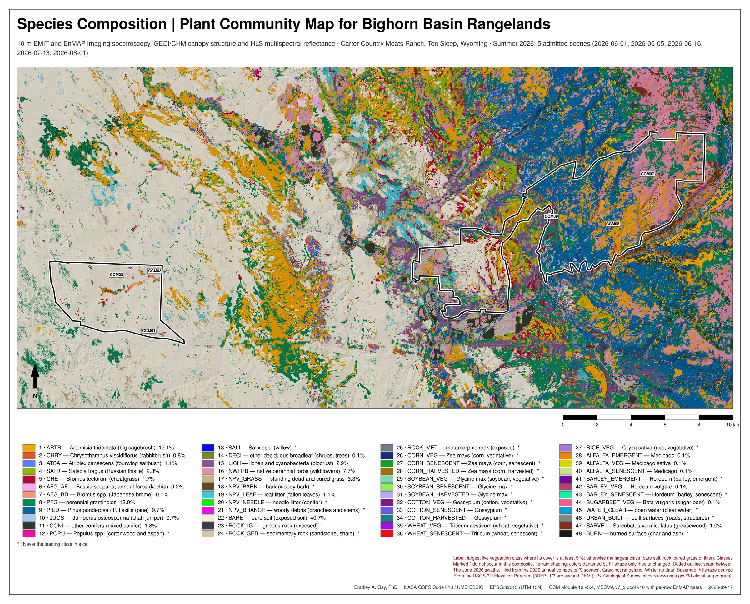
Largest live vegetation class at 5 % cover or more, else the substrate class; 48 classes keyed; 10 m.
PDF · SVG · GeoTIFF
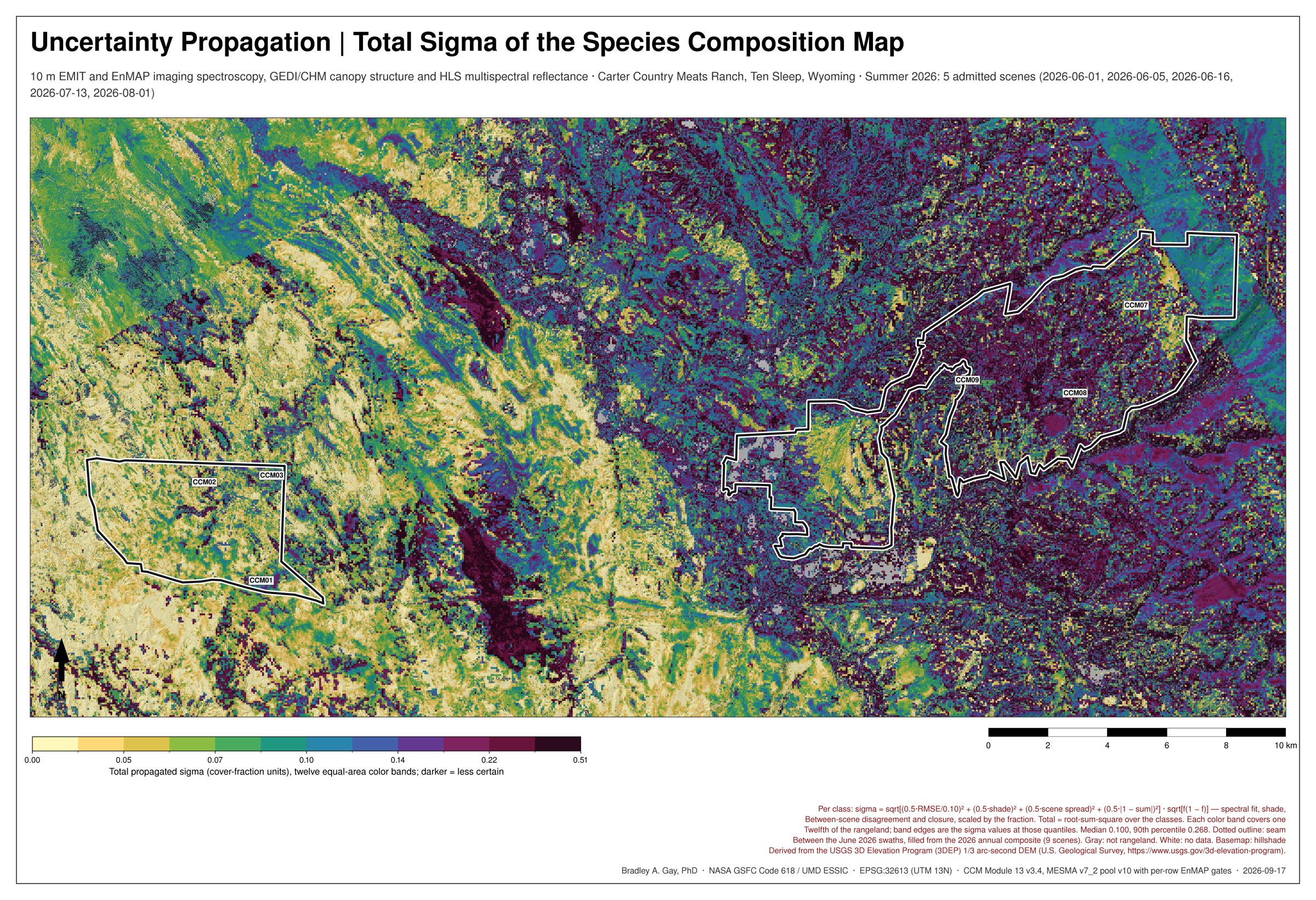
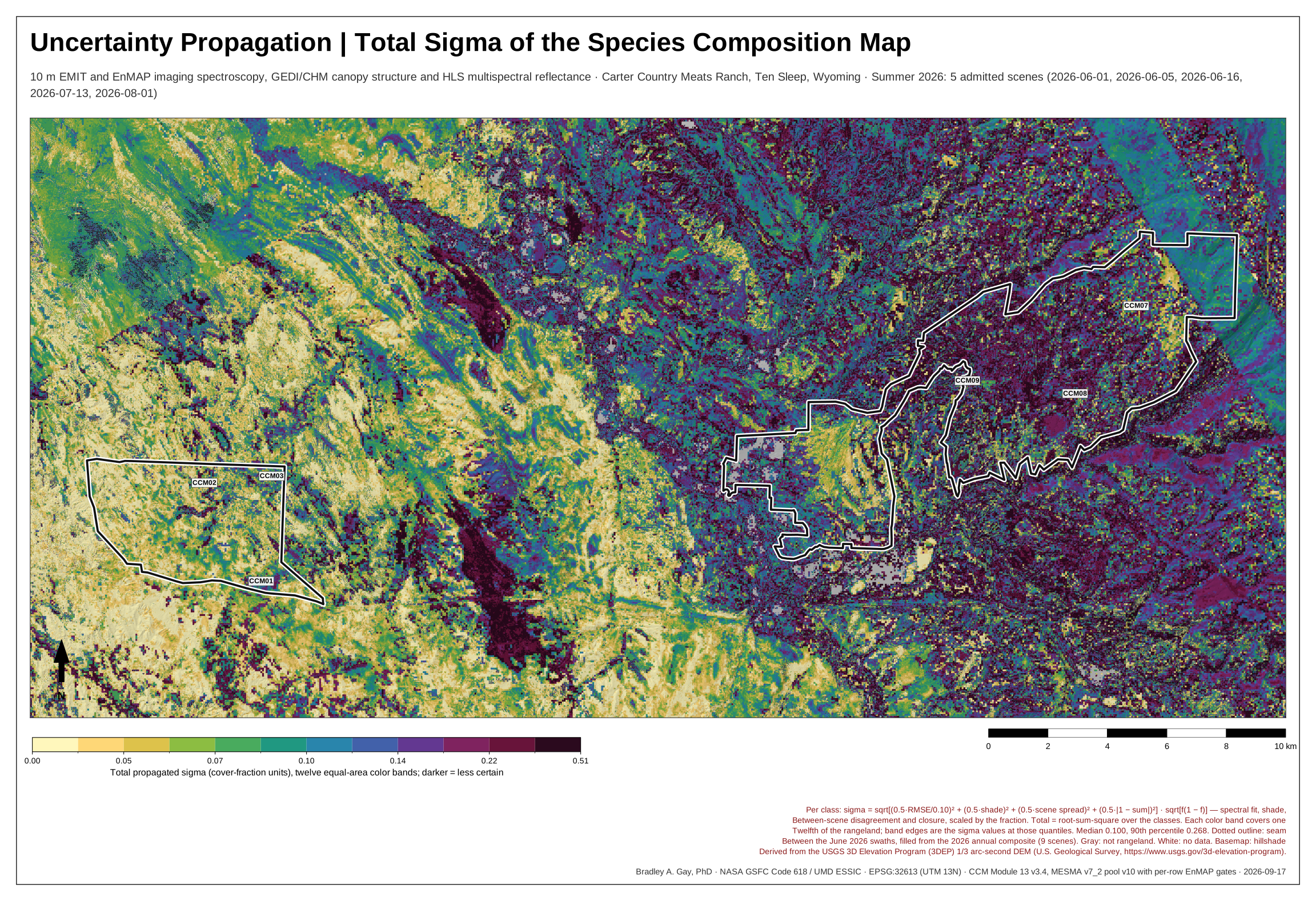
Root-sum-square of the class sigmas in twelve equal-area bands; darker = less certain.
PDF · SVG · GeoTIFF
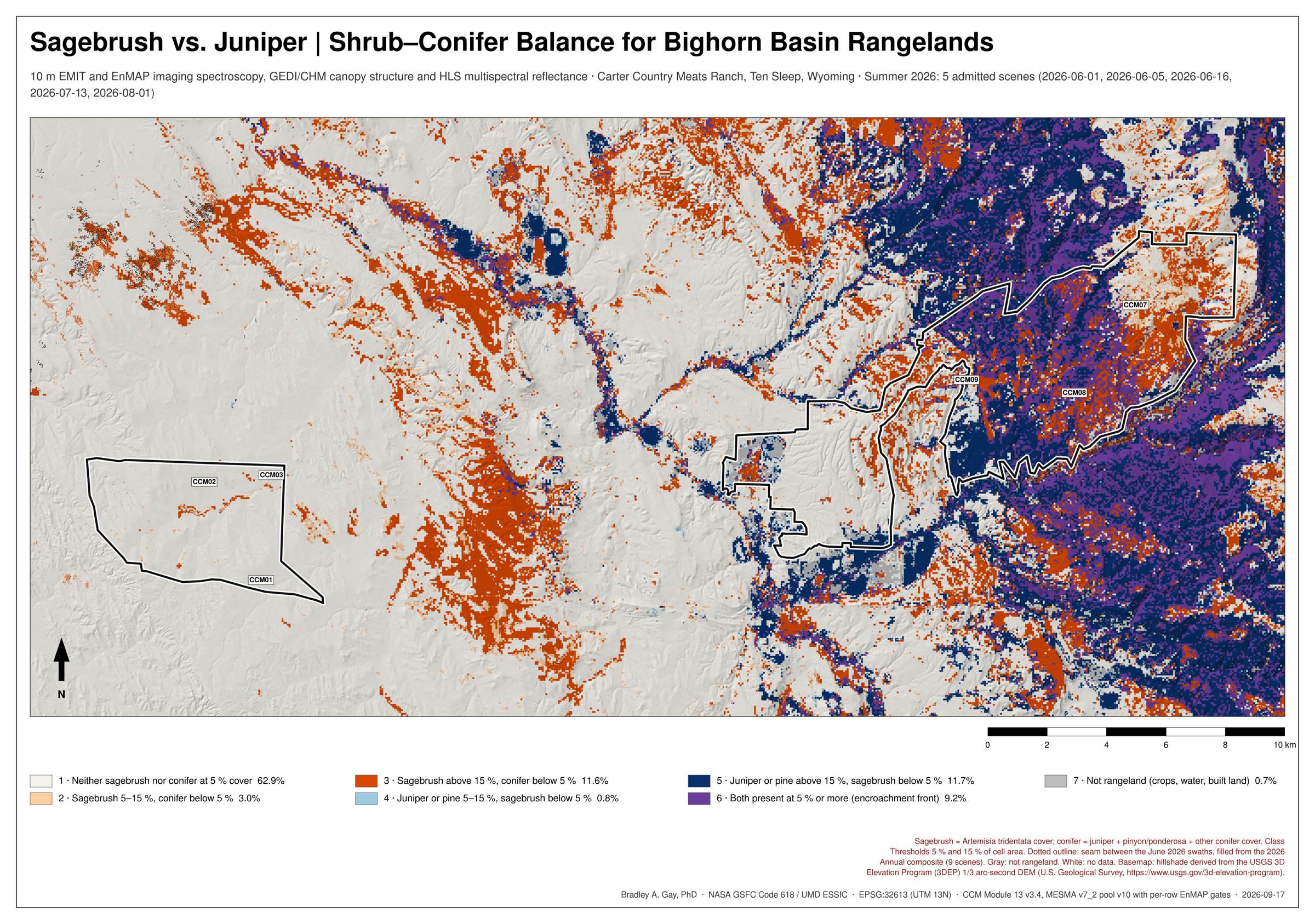
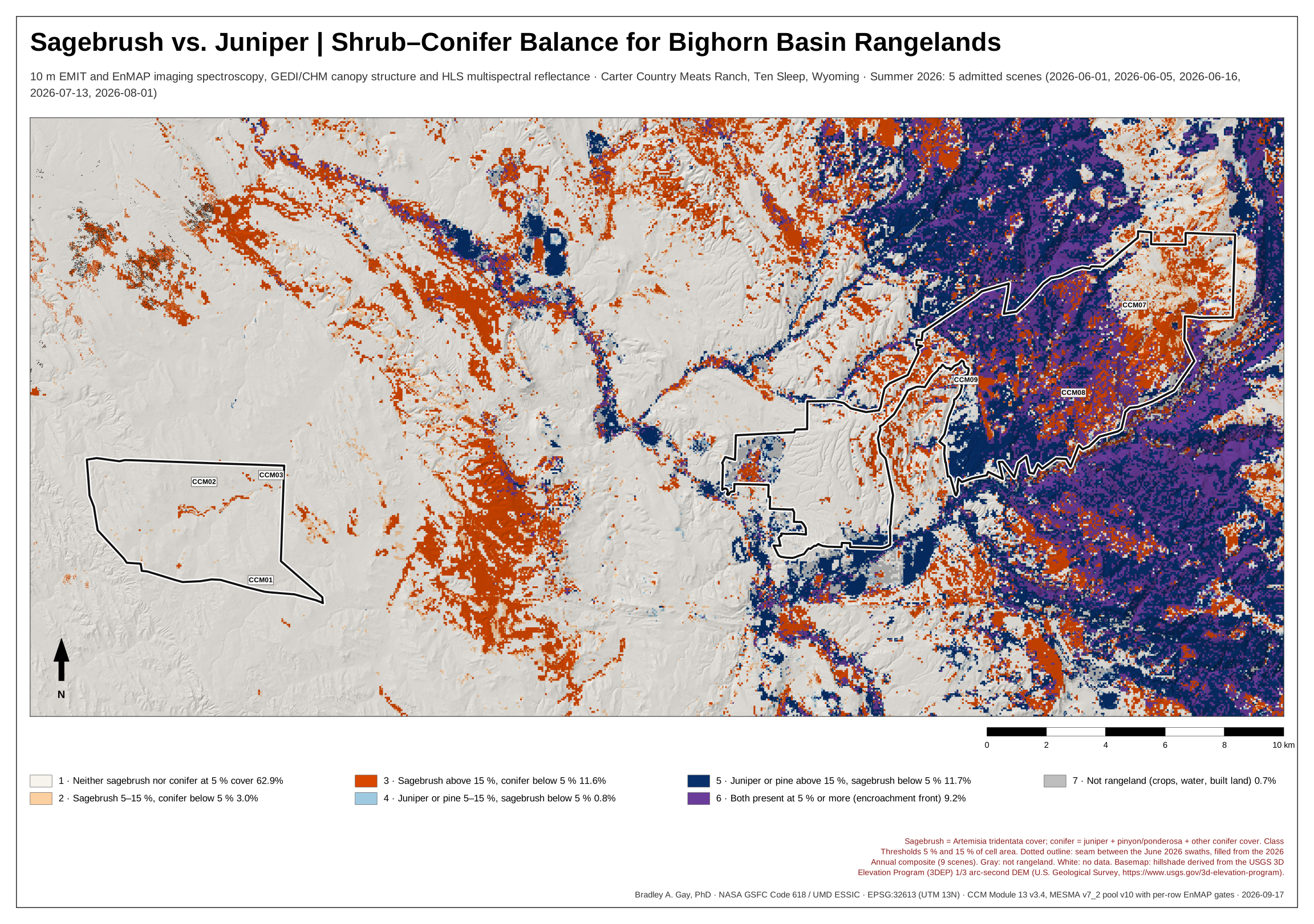
Seven classes at 5 % and 15 % cover; purple = both present, the encroachment front.
PDF · SVG · GeoTIFF
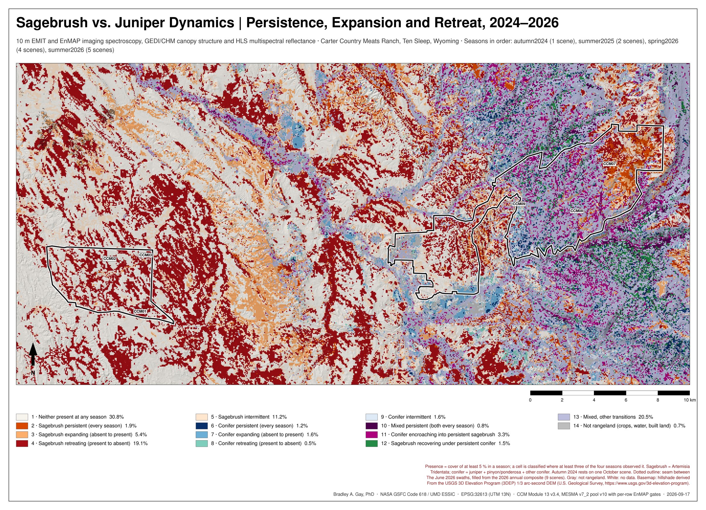
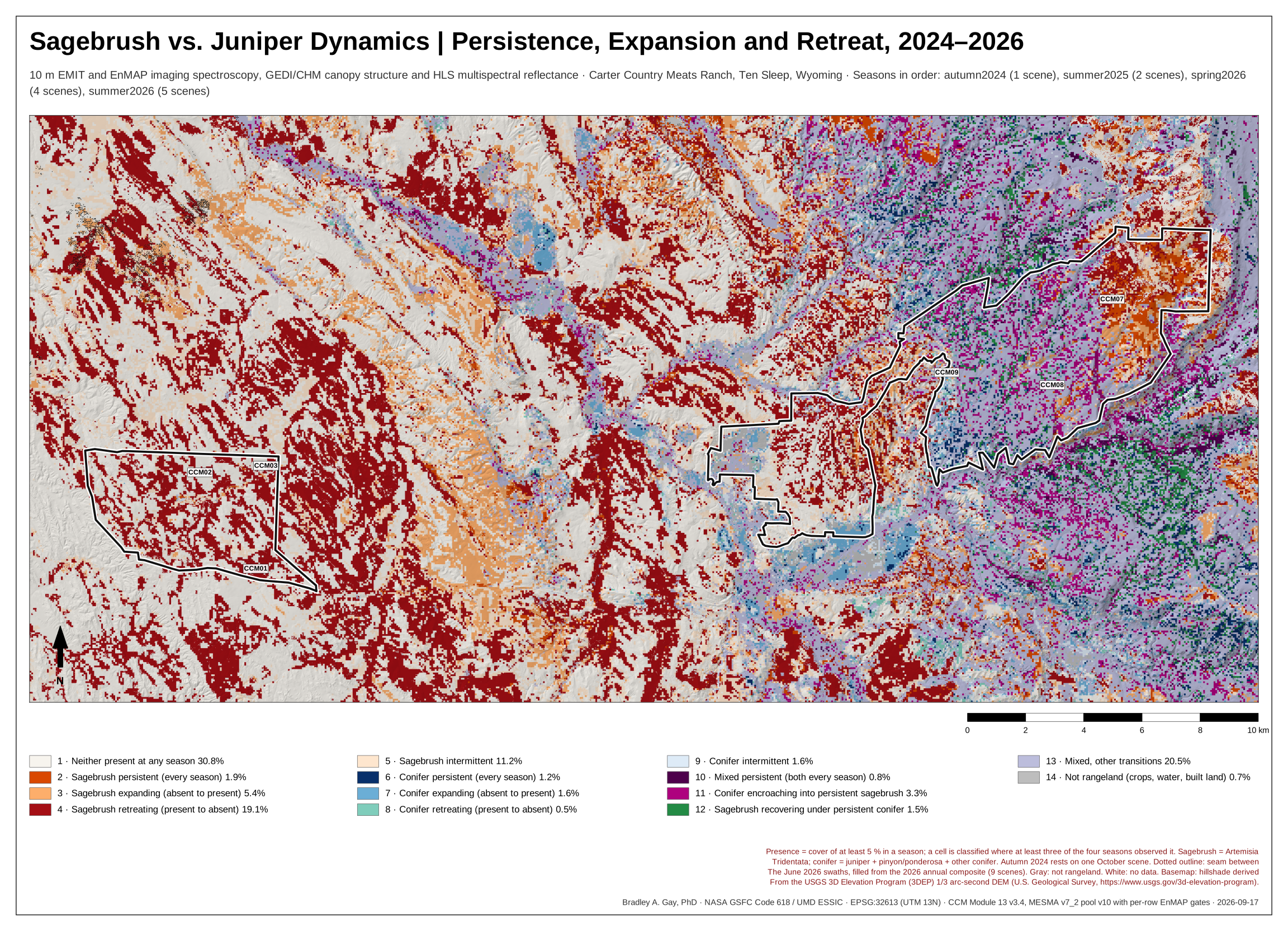
Fourteen trajectory classes across autumn 2024, summer 2025, spring 2026 and summer 2026.
PDF · SVG · GeoTIFF
Quantified change acres by component and ownership
Atlas: Evidence · Decision · Method — Validated against the 11–12 Aug 2026 field campaign: composition error 19.8 pp over 23 class–site pairs.